Introduction
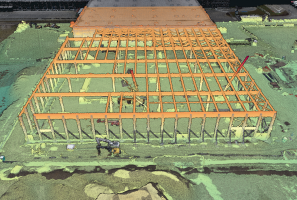
Monitoring construction progress using drone and photogrammetric data has become a standard for construction projects in recent years. Drones make it possible to quickly
and securely acquire up-to-date spatial data that faithfully reflects the actual condition of a construction site. Combined with advanced photogrammetric processing and the SkySnap Portal, they form a consistent tool for quality, schedule and cost control of investments.
The greatest value of drone monitoring is access to the most up-to-date
and accurate data. Photogrammetric raids provide objective documentation of construction, independent of subjective assessments or textual descriptions. This type of data can be used repeatedly – both at the stage of project implementation and after its completion, for example, in the processes of property maintenance, infrastructure management or planning further expansion.
SkySnap Portal construction monitoring – a single source of truth
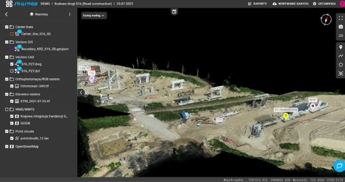
A key element of successful construction monitoring is not only the acquisition of the data itself, but also its proper organization and sharing. The SkySnap portal makes it possible to integrate all photogrammetric and geospatial data in one central location. This allows all people involved in the project to work on the same up-to-date materials, without the risk of using outdated files or different versions of documentation.
Access to data is fully controlled – the project administrator decides who can view or analyze materials and to what extent. This approach significantly improves communication between the developer, contractor, designers and technical supervision.
Drone mission planning – the foundation of effective monitoring
The construction monitoring process begins long before the first drone flight. Already at the mission planning stage, the objectives of the raid are determined, as well as requirements for the accuracy
and detail of the output data. This is the moment when it is determined whether an orthophoto, a point cloud, a numerical terrain model or all three simultaneously will be crucial.
Planning includes preparation of raid parameters, i.e. flight route, selection of altitude and shooting parameters, and, if necessary, planning of field photopoints, so that the collected data allows to achieve the required detail and accuracy of output data. Equally important is checking weather conditions and preparing equipment. At this stage, the client, the SkySnap expert and, depending on the cooperation model, the drone pilot are involved in the process.
The frequency of raids is also jointly determined. Depending on the dynamics of the investment, they can take place weekly, bi-weekly or once a month. The regularity of the raids makes it possible to build a complete history of the project’s implementation and accurately track the progress of the work.
Learn more about the parameters of a photogrammetric drone raid in the article below:
How to plan a drone mission to make the data suitable for photogrammetry? [GUIDE] – SkySnap
Photogrammetric raid – acquisition of up-to-date construction data
The photogrammetric flight itself is the stage where the plan turns into concrete data. Prior to the flight, the operator makes a preliminary visual inspection of the study area and, if necessary, makes minor adjustments to the flight route, such as in an application that allows automatic drone missions. The flight is then executed as planned, and the collected images are subjected to preliminary quality verification.
If during the inspection it turns out that material needs to be supplemented in some places, the operator can take additional images. In this way, the risk of deficiencies that could affect the quality of analysis is minimized already at the stage of data acquisition. The drone pilot participates in the raid, and the presence of the client is usually not required.
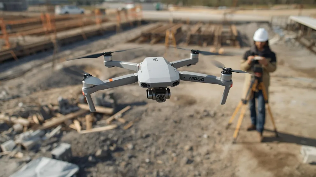
It is worth noting that a drone pilot must meet certain legal requirements. At the initial stage of the drone business, it is worth considering hiring a drone pilot with the appropriate qualifications, while ultimately the most cost-effective solution is to acquire such licenses personally. Flights are carried out in accordance with European Union and national regulations on unmanned aircraft. This includes having the proper credentials, insurance, and adherence to safety rules, among other things.
Professional effects using a „small drone” – please see the webinar below:
Webinar 08.01 SkySnap: How to perform a photogrammetric raid with a small drone
Processing of photogrammetric data
After the raid is completed, the images go to photogrammetric processing. At this stage orthophotos, point clouds and numerical terrain models are created, the accuracy and detail of which are in accordance with previous arrangements. Processing can be carried out by SkySnap specialists or, if the client has the necessary facilities, directly by its team.
The result of this stage is precise spatial data, which forms the basis for further analysis and comparison. Importantly, this data is not only visually clear, but also measurable, making it possible to perform volume, height or area calculations and detailed analyses.
Analysis and comparison with design documents and BIM
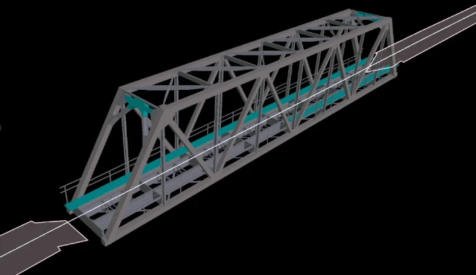
One of the biggest advantages of the SkySnap Portal is the ability to directly compare photogrammetric data with project documentation and BIM models. Users can collate data from different stages of construction or from different dates on a single screen, making it easy to assess the pace of work and the conformity of execution with plans.
Such comparisons make it significantly easier to identify potential problems and deviations before they become costly or difficult to fix.
Error detection and risk management
Regular monitoring of the construction site makes it possible to quickly detect execution errors, discrepancies with the design or potential health and safety hazards. Early identification of problems allows for immediate response and implementation of corrective actions.
In practice, it often turns out that detecting one major error early in the project saves much more time and resources than the cost of drone monitoring throughout the construction period.
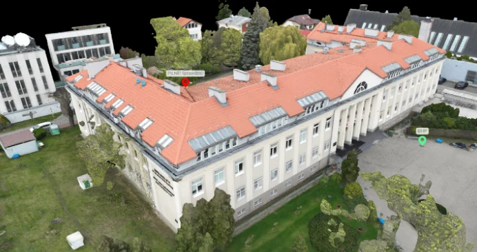
Control of milestone achievement
Thanks to cyclic photogrammetric raids, it is possible to monitor the implementation of milestones on an ongoing basis and verify whether the investment is proceeding according to schedule. This is especially important for large and complex projects, such as linear investments (e.g., expressways, city bypass, railroad), large cubic objects (e.g., shopping center, logistics center, apartment block), housing developments or aggregate stockpile management.
Summary – real benefits of drone construction monitoring
Monitoring the progress of construction using a drone and the SkySnap Portal is an effective way to organize the investment process and increase control over the execution of work. Systematic acquisition of data from the air makes it possible to reliably assess the current state of construction, reduce the risk of errors and make decisions based on the real picture of the investment, rather than fragmentary information from the construction site. The most important benefits of monitoring construction progress with a drone:
- Rapid identification of non-compliance with the project and schedule,
- The ability to compare successive stages of implementation over time,
- Reduce costly fixes by detecting problems early,
- Better coordination of work and communication between participants in the investment.
The integrated environment of the SkySnap Portal makes it possible to work on shared, always up-to-date data, to which only authorized persons have access. As a result, construction monitoring becomes not only a tool for control, but also a long-term support for investment management, which retains its value even after the completion of construction work.
We also invite you to the article at the following link, where you will find more detailed information on the issue of monitoring construction progress:
How to effectively monitor construction progress with a drone? A beginner’s guide – SkySnap

Darmowy E-book
Pomiar objętości materiałów, kruszyw oraz robót ziemnych na placu budowy to jeden z najważniejszych zastosowań dronów. Dlaczego? Bo to czas i pieniądze! Pobierz nasz krótki e-book i dowiedz się jak możesz monetyzować swoją pasję z dronów.
Table of Contents:
Podoba Ci się artykuł? Podziel się nim z innymi!
Podoba Ci się artykuł? Podziel się nim z innymi!
Informacje o autorze
Intern Operations
Porady, wiadomości, spostrzeżenia
Powiązane artykuły
Sprawdź nasze artykuły i poznaj najnowsze informacje z branży.