In this age of technological advances, we need tools that allow us to track dynamic changes in the space around us. Fortunately, we now have a remarkable solution at our disposal in the form of SkySnap Portal 2.0. But how do we use this tool to detect changes and analyze progress? Here’s a quick guide.
What is SkySnap Geoportal 2.0?
The SkySnap 2.0 portal is an advanced platform for space analysis and monitoring. By using the latest satellite technology, it makes it possible to observe and analyze changes occurring on the Earth’s surface.
How to detect changes using SkySnap Portal 2.0?
Detecting changes using the SkySnap 2.0 Portal is simple and intuitive. All you have to do is identify the area of interest on the map and then define the monitoring parameters. The portal will compare available satellite images from different periods and show the changes occurring on them.
Analytical capabilities of the SkySnap 2.0 Portal
The SkySnap 2.0 portal not only enables the detection of changes, but also their precise analysis. It offers a number of advanced features to help understand the context and dynamics of the changes noticed. For example, we can check how the vegetation cover in an area is changing, or monitor changes occurring in the structure of a city. These and many other functions make the Portal an indispensable tool in the work of many specialists.
Practical application of SkySnap Portal 2.0
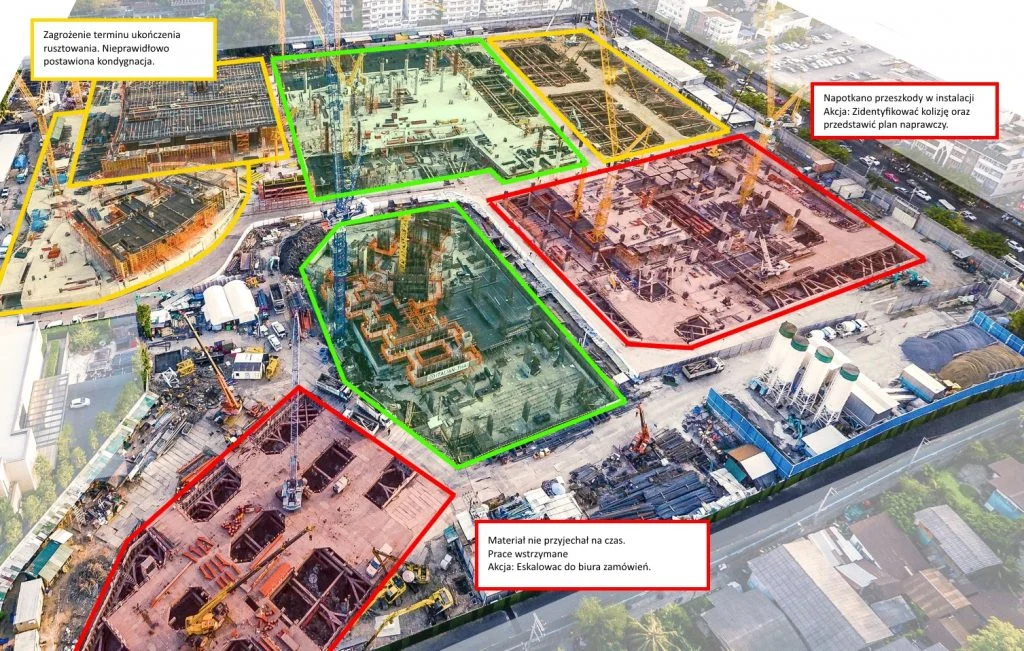
The SkySnap 2.0 geoportal is widely used in both business and public activities. For example, businesses can use it to monitor the progress of work on major construction sites, and local government units can use it to analyze changes in urban land use. With this tool, it is also possible to conduct precise analysis of the effects of natural disasters or maintenance of the country’s strategic infrastructure.
Where is SkySnap Portal 2.0 available?
The SkySnap 2.0 portal is available online, so you can use it from anywhere in the world. You can also take advantage of numerous tutorials and tutorials that will help you effectively use all the features of this platform.

Darmowy E-book
Pomiar objętości materiałów, kruszyw oraz robót ziemnych na placu budowy to jeden z najważniejszych zastosowań dronów. Dlaczego? Bo to czas i pieniądze! Pobierz nasz krótki e-book i dowiedz się jak możesz monetyzować swoją pasję z dronów.
Table of Contents
Informacje o autorze
Michał
Porady, wiadomości, spostrzeżenia
Powiązane artykuły
Sprawdź nasze artykuły i poznaj najnowsze informacje z branży.